
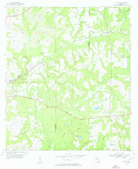
1954 Map of Lloyd
USGS Topo · Published 1955About this map
Lloyd and its surrounding rural hamlets are defined by the karst landscape of the Florida Panhandle during the mid-1950s. The geography is characterized by numerous sinkholes and ponds, such as Copeland Sink, Patty Sink, and Upchurch Pond, reflecting the underlying limestone terrain. The Seaboard Air Line railroad provides a critical east-west corridor through the county line between Leon and Jefferson counties, connecting the settlements of Chaires and Capitola to the regional network. Small country churches and family burial grounds are frequent, including Union Branch Ch and Skipper Cem. To the south, the headwaters and branches of the St Marks River and Sweetwater Branch weave through low-lying areas like Willow Swamp, illustrating the intricate drainage patterns of the coastal plain before later 20th-century development altered the local water table.
Find a feature on this map
43 named features on this map. Tap any name to fly to it.
Don’t see what you’re looking for? This feature index may not catch every label — zoom into the map to look around manually.
Map Details
Editions of this 1954 Lloyd Map
2 editions found
Other maps of this area

1954 · Lafayette
USGS Topo · 1:24,000

1954 · Cody
USGS Topo · 1:24,000

1954 · Woodville
USGS Topo · 1:24,000

1954 · Valdosta
USGS Topo · 1:250,000

1954 · Tallahassee
USGS Topo · 1:250,000

1955 · Waukeenah
USGS Topo · 1:24,000

1955 · Wacissa
USGS Topo · 1:24,000

1958 · Valdosta
USGS Topo · 1:250,000

1959 · Tallahassee
USGS Topo · 1:250,000

1959 · Valdosta
USGS Topo · 1:250,000