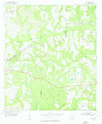
1954 Map of Lloyd
USGS Topo · Published 1955About this map
The Seaboard Air Line railroad cuts a diagonal path through the panhandle terrain, connecting the small settlements of Lloyd, Capitola, and Chaires. This mid-century survey reveals a landscape defined by its karst topography, where numerous geological depressions such as Patty Sink, Bird Sink, and Copeland Sink dominate the drainage patterns. These natural sinks and ponds, including Upchurch Pond and Story Lake, are interspersed with rural community landmarks like Elizabeth Ch and Springfield Ch, which anchor the surrounding homesteads and small farms.
Find a feature on this map
43 named features on this map. Tap any name to fly to it.
Don’t see what you’re looking for? This feature index may not catch every label — zoom into the map to look around manually.
Map Details
Editions of this 1954 Lloyd Map
2 editions found
Other maps of this area

1954 · Lloyd
USGS Topo · 1:24,000

1954 · Lafayette
USGS Topo · 1:24,000

1954 · Cody
USGS Topo · 1:24,000

1954 · Woodville
USGS Topo · 1:24,000

1954 · Valdosta
USGS Topo · 1:250,000

1954 · Tallahassee
USGS Topo · 1:250,000

1955 · Waukeenah
USGS Topo · 1:24,000

1955 · Wacissa
USGS Topo · 1:24,000

1958 · Valdosta
USGS Topo · 1:250,000

1959 · Tallahassee
USGS Topo · 1:250,000