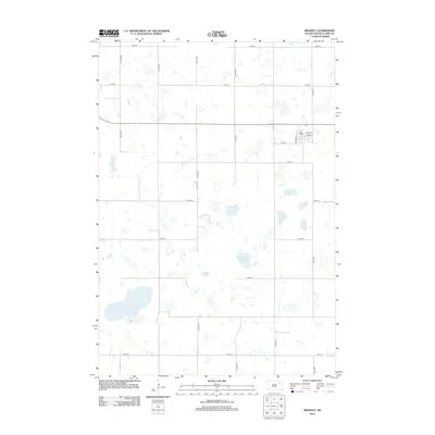
2012 Map of Bradley
USGS Topo · Published 2012About this map
Bradley serves as the primary hub of this eastern South Dakota landscape, appearing here in the early 21st century as a small community defined by its grid of local streets including Main St and Railway St. The presence of the Po at the center of town marks the continued civic importance of this settlement amidst the expansive agricultural sections of Clark County. The surrounding terrain is characterized by numerous prairie potholes and wetlands, most notably the larger bodies of Reid Lake to the southwest and Madian Lake to the east. A precise network of section-line roads, such as 424th Ave and 156th St, divide the territory into the traditional township and range squares common to the Great Plains, illustrating a land use pattern that has remained consistent for over a century.
Find a feature on this map
21 named features on this map. Tap any name to fly to it.
Don’t see what you’re looking for? This feature index may not catch every label — zoom into the map to look around manually.
Map Details
Editions of this 2012 Bradley Map
This is the sole edition of this map. No revisions or reprints were ever made.
Other maps of this area

1953 · Milbank
USGS Topo · 1:250,000

1953 · Watertown
USGS Topo · 1:250,000

1958 · Milbank
USGS Topo · 1:250,000

1958 · Watertown
USGS Topo · 1:250,000

1973 · Lily
USGS Topo · 1:24,000

1973 · Swan Lake
USGS Topo · 1:24,000

1973 · Bradley
USGS Topo · 1:24,000

1973 · Lone Tree Lake
USGS Topo · 1:24,000

1973 · Heggs Lake
USGS Topo · 1:24,000
1973 · Crocker
USGS Topo · 1:24,000