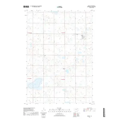
2017 Map of Bradley
USGS Topo · Published 2017About this map
Bradley sits as the central settlement within this portion of Clark County, positioned atop the undulating glacial terrain of the Coteau des Prairies. This highland region is defined by a dense network of prairie potholes and semi-permanent basins, with Cottonwood Lake, Madian Lake, and Reid Lake forming prominent landmarks across the prairie landscape. The town itself is laid out along Main St and Bentley Ave, serving as a localized hub for the surrounding agricultural sections. Evidence of long-standing community roots appears just outside the town limits, including Calvary Lutheran church and the Prairie Hill Cem. The map illustrates a strictly organized grid of section roads like 429th Ave and 157th St, reflecting the persistent influence of the Public Land Survey System on South Dakota's rural development and land use patterns.
Find a feature on this map
23 named features on this map. Tap any name to fly to it.
Don’t see what you’re looking for? This feature index may not catch every label — zoom into the map to look around manually.
Map Details
Editions of this 2017 Bradley Map
This is the sole edition of this map. No revisions or reprints were ever made.
Other maps of this area

1953 · Milbank
USGS Topo · 1:250,000

1953 · Watertown
USGS Topo · 1:250,000

1958 · Milbank
USGS Topo · 1:250,000

1958 · Watertown
USGS Topo · 1:250,000

1973 · Lily
USGS Topo · 1:24,000

1973 · Swan Lake
USGS Topo · 1:24,000

1973 · Bradley
USGS Topo · 1:24,000

1973 · Lone Tree Lake
USGS Topo · 1:24,000

1973 · Heggs Lake
USGS Topo · 1:24,000
1973 · Crocker
USGS Topo · 1:24,000