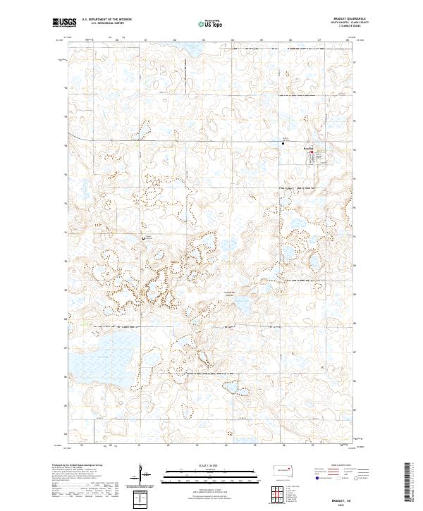
2021 Map of Bradley
USGS Topo · Published 2021About this map
Bradley stands as the primary settlement on this portion of the Coteau des Prairies, a vast glacial plateau that defines the local topography. The town’s grid is clearly delineated, featuring streets such as Main St, Bentley Ave, and McKinney Ave. This area of Clark County is characterized by a high density of small wetlands and larger water bodies, including Cottonwood Lake, Madian Lake, and the expansive Reid Lake to the southwest. Cultural markers of the rural community are preserved through landmarks like Calvary Lutheran church and the Prairie Hill Cem located just west of the town center. The landscape is interconnected by a network of section-line roads, including Co Rd 3 and Co Rd 4, which facilitate travel between the scattered homesteads and the central hub of Bradley.
Find a feature on this map
25 named features on this map. Tap any name to fly to it.
Don’t see what you’re looking for? This feature index may not catch every label — zoom into the map to look around manually.
Map Details
Editions of this 2021 Bradley Map
This is the sole edition of this map. No revisions or reprints were ever made.
Other maps of this area

1953 · Milbank
USGS Topo · 1:250,000

1953 · Watertown
USGS Topo · 1:250,000

1958 · Milbank
USGS Topo · 1:250,000

1958 · Watertown
USGS Topo · 1:250,000

1973 · Lily
USGS Topo · 1:24,000

1973 · Swan Lake
USGS Topo · 1:24,000

1973 · Bradley
USGS Topo · 1:24,000

1973 · Lone Tree Lake
USGS Topo · 1:24,000

1973 · Heggs Lake
USGS Topo · 1:24,000
1973 · Crocker
USGS Topo · 1:24,000