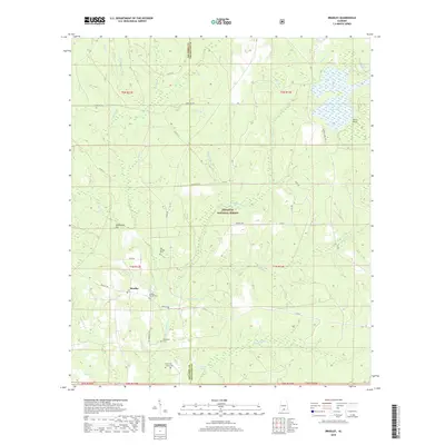
2018 Map of Bradley
USGS Topo · Published 2018About this map
Bradley serves as the focal point for this rural landscape where the Blackwater River and its various tributaries, such as Hurricane Cr and Blackwater Cr, carve through the terrain. The presence of the Conecuh National Forest defines the eastern and southern portions of the map, preserving a landscape of dense drainage basins and wetlands like Bear Bay and Otter Pond. Local family and community history is anchored by several burial sites, including the Old Bradley Cem and Blackwater Cem, alongside the Bradley Church Cem and Union Hill Church Cem. Significant landforms such as Sandstone Hill and Sand Point rise above the complex network of creeks like Fish Trap Br and Wolf Pit Br, illustrating the elevation shifts between the Escambia and Covington county lines.
Find a feature on this map
51 named features on this map. Tap any name to fly to it.
Don’t see what you’re looking for? This feature index may not catch every label — zoom into the map to look around manually.
Map Details
Editions of this 2018 Bradley Map
This is the sole edition of this map. No revisions or reprints were ever made.
Other maps of this area

1948 · Munson
USGS Topo · 1:62,500

1949 · Crestview
USGS Topo · 1:62,500

1950 · Munson
USGS Topo · 1:62,500

1951 · Crestview
USGS Topo · 1:62,500

1953 · Andalusia
USGS Topo · 1:250,000

1957 · Andalusia
USGS Topo · 1:250,000

1957 · Pensacola
USGS Topo · 1:250,000

1959 · Pensacola
USGS Topo · 1:250,000

1960 · Pensacola
USGS Topo · 1:250,000

1971 · Dixie
USGS Topo · 1:24,000