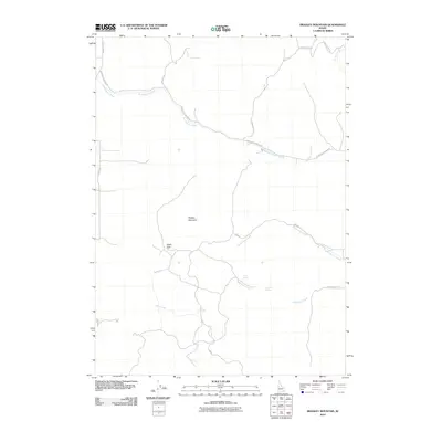
2010 Map of Bradley Mountain
USGS Topo · Published 2010About this map
Bradley Mountain anchors this high-elevation landscape in Bannock County, Idaho, where a complex network of local roads and creek beds defines the rural character of the terrain. The northern section is dominated by the winding path of Rattlesnake Creek, flanked by Upper Rattlesnake Rd and S Mink Creek Rd. These thoroughfares, along with Wright Ln and Mercer Creek RD, suggest a sparsely populated area where land use is likely tied to ranching or seasonal grazing, as evidenced by the naming of several isolated water sources such as Rock Spring, Hawkins Spring, and Bull Spring. In the southern half, the elevation transitions through Eagle Pass, leading toward the headwaters of Dairy Creek and Deadwood Creek. The presence of several distinct drainages including Yellow Dog Creek and Garden Creek highlights the importance of water management in this high-desert mountain environment.
Find a feature on this map
19 named features on this map. Tap any name to fly to it.
Don’t see what you’re looking for? This feature index may not catch every label — zoom into the map to look around manually.
Map Details
Editions of this 2010 Bradley Mountain Map
This is the sole edition of this map. No revisions or reprints were ever made.
Other maps of this area

1938 · Pauline
USGS Topo · 1:48,000

1944 · Arbon
USGS Topo · 1:62,500

1954 · Pocatello
USGS Topo · 1:250,000

1958 · Pocatello
USGS Topo · 1:250,000

1968 · Dairy Creek
USGS Topo · 1:24,000

1968 · Wakley Peak
USGS Topo · 1:24,000

1968 · Hawkins
USGS Topo · 1:24,000

1968 · Clifton Creek
USGS Topo · 1:24,000

1968 · Bradley Mtn
USGS Topo · 1:24,000
1968 · Scout Mtn
USGS Topo · 1:24,000