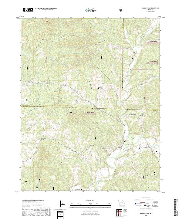
2021 Map of Bradleyville
USGS Topo · Published 2021About this map
Bradleyville serves as the central hub for this portion of the Ozarks, situated near the confluence of Beaver Creek and several smaller tributaries. The landscape is defined by an intricate network of deep drainages, including Roller Hollow, Clayton Hollow, and Patterson Hollow, which create a complex topography typical of the Mark Twain National Forest. Local history is anchored by numerous small family cemeteries scattered throughout the timbered hills, such as Whitaker Cem, Blair Cem, and Martin Cem. The road network reflects the area's agricultural and industrial past, featuring routes like Old Cheese Plant Rd and Cedar Hollow Rd. This survey documents a quiet rural landscape where the placement of Bradleyville Cem and other burial grounds along the ridges provides a clear map of early settlement patterns and family lineage.
Find a feature on this map
47 named features on this map. Tap any name to fly to it.
Don’t see what you’re looking for? This feature index may not catch every label — zoom into the map to look around manually.
Map Details
Editions of this 2021 Bradleyville Map
This is the sole edition of this map. No revisions or reprints were ever made.
Other maps of this area

1907 · Forsyth
USGS Topo · 1:125,000

1937 · Bradleyville
USGS Topo · 1:48,000

1943 · Protem
USGS Topo · 1:62,500

1943 · Bradleyville
USGS Topo · 1:62,500

1945 · Harrison
USGS Topo · 1:250,000

1945 · Bradleyville
USGS Topo · 1:62,500

1949 · Harrison
USGS Topo · 1:250,000

1954 · Harrison
USGS Topo · 1:250,000

1955 · Garrison
USGS Topo · 1:24,000
1955 · Chadwick
USGS Topo · 1:24,000