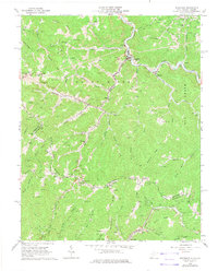
1964 Map of Bradshaw
USGS Topo · Published 1975About this map
Bradshaw sits at the confluence of Bradshaw Creek and the Sandy River, serving as a central hub for the coal-country communities of McDowell County during the mid-1960s. The landscape is defined by its industrial and social infrastructure, where the Norfolk and Western railroad follows the river bends to service small settlements like Raysal and Atwell. The map reveals a deeply rooted rural society, evidenced by the high density of family-named cemeteries and community landmarks such as the Wimmer Pilgrim Rest Cem Ch and Bee Branch Ch.
Find a feature on this map
93 named features on this map. Tap any name to fly to it.
Don’t see what you’re looking for? This feature index may not catch every label — zoom into the map to look around manually.
Map Details
Editions of this 1964 Bradshaw Map
3 editions found
Other maps of this area

1891 · Tazewell
USGS Topo · 1:125,000

1895 · Tazewell
USGS Topo · 1:125,000

1897 · Tazewell
USGS Topo · 1:125,000

1910 · Iaeger
USGS Topo · 1:48,000

1912 · Pounding Mill
USGS Topo · 1:62,500

1912 · Iaeger
USGS Topo · 1:62,500

1912 · Welch
USGS Topo · 1:62,500

1914 · Iaeger
USGS Topo · 1:48,000

1915 · Richlands
USGS Topo · 1:48,000

1916 · Pounding Mill
USGS Topo · 1:62,500