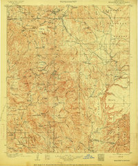
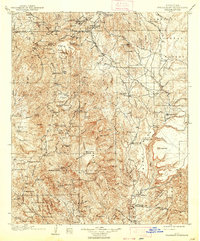
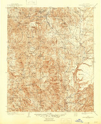
1903 Map of Bradshaw Mountains
USGS Topo · Published 1915About this map
Mining operations and remote ranching outposts define this 1903 survey of the Bradshaw Mountains, a region then thick with precious metal extraction and the infrastructure of the Prescott National Forest. Industrial sites like the Valverde Smelter and Boggs Smelter anchor the northern reaches, while specialized stamps and processing centers such as Stormcloud Mill and Lehman's Mill are scattered near peaks like Mt Union.
Find a feature on this map
116 named features on this map. Tap any name to fly to it.
Don’t see what you’re looking for? This feature index may not catch every label — zoom into the map to look around manually.
Map Details
Editions of this 1903 Bradshaw Mountains Map
4 editions found
Other maps of this area

1887 · Verde
USGS Topo · 1:250,000

1887 · Prescott
USGS Topo · 1:250,000

1892 · Verde
USGS Topo · 1:250,000

1892 · Prescott
USGS Topo · 1:250,000

1903 · Bradshaw Mountains
USGS Topo · 1:125,000

1903 · Congress
USGS Topo · 1:125,000

1904 · Congress
USGS Topo · 1:125,000

1905 · Jerome
USGS Topo · 1:125,000

1923 · Camp Verde
USGS Topo · 1:125,000

1929 · Turret Peak
USGS Topo · 1:125,000