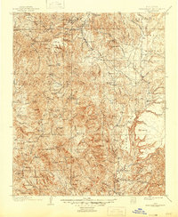
1903 Map of Bradshaw Mountains
USGS Topo · Published 1946About this map
Mining operations and remote ranches define this high-altitude Arizona landscape at the turn of the century. The northern reaches are dominated by industrial activity, where the Boggs Smelter and several processing facilities like Stormcloud Mill and Pickerell Mill served the mineral-rich mountains. Transportation for these ore-heavy districts relied on the Prescott and Eastern RR, which winds through the terrain toward settlements such as Mayer and Poland. To the south, the landscape shifts toward isolated family outposts and rugged cattle country, evidenced by the numerous named properties like Fentons Ranch, Donnelly Ranch, and Simpsons Ranch. Prominent peaks like Mt Union and Tuscombia Mt tower over the Hassayampa River headwaters, while the legendary settlement of Crown King stands as a testament to the era's deep-mountain gold and silver interests.
Find a feature on this map
95 named features on this map. Tap any name to fly to it.
Don’t see what you’re looking for? This feature index may not catch every label — zoom into the map to look around manually.
Map Details
Editions of this 1903 Bradshaw Mountains Map
4 editions found
Other maps of this area

1887 · Verde
USGS Topo · 1:250,000

1887 · Prescott
USGS Topo · 1:250,000

1892 · Verde
USGS Topo · 1:250,000

1892 · Prescott
USGS Topo · 1:250,000

1903 · Bradshaw Mountains
USGS Topo · 1:125,000

1903 · Congress
USGS Topo · 1:125,000

1904 · Congress
USGS Topo · 1:125,000

1905 · Jerome
USGS Topo · 1:125,000

1923 · Camp Verde
USGS Topo · 1:125,000

1929 · Turret Peak
USGS Topo · 1:125,000