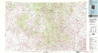
1981 Map of Bradshaw Mts
USGS Topo · Published 1996About this map
Prescott National Forest anchors the high country of this 1980s-era topographic survey, revealing a landscape defined by its mining heritage and transit corridors. The rugged Bradshaw Mountains are marked by significant historic operations like the Crown King Mine and Golden Turkey Mine, reflecting the region’s long-standing reliance on extraction. Settlement patterns follow the topography, with small communities such as Cleator, Bumble Bee, and Wagoner scattered among the peaks and canyons.
Find a feature on this map
45 named features on this map. Tap any name to fly to it.
Don’t see what you’re looking for? This feature index may not catch every label — zoom into the map to look around manually.
Map Details
Editions of this 1981 Bradshaw Mts Map
2 editions found
Other maps of this area

1887 · Verde
USGS Topo · 1:250,000

1887 · Prescott
USGS Topo · 1:250,000

1892 · Verde
USGS Topo · 1:250,000

1892 · Prescott
USGS Topo · 1:250,000

1903 · Bradshaw Mountains
USGS Topo · 1:125,000

1903 · Congress
USGS Topo · 1:125,000

1904 · Congress
USGS Topo · 1:125,000

1905 · Jerome
USGS Topo · 1:125,000

1923 · Camp Verde
USGS Topo · 1:125,000

1923 · Signal
USGS Topo · 1:250,000