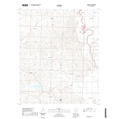
2020 Map of Bragg City
USGS Topo · Published 2020About this map
Ouachita River oxbows and bottomlands dominate the eastern edge of this Ouachita County landscape, where Old River Island and Upper Old Brake indicate the shifting course of the waterway. Further west, the terrain transitions into a network of small settlements and family burial grounds connected by rural routes like Quachita Road 62 and State Hwy 76. The map captures a primarily agricultural and timber-focused region defined by the drainage of Ecore Fabre Bayou and Bragg Mill Cr. Genealogists will find local history preserved at Bragg Cem, Green Cem, and Tate Cem, which serve the communities of Bragg City, Lester, and Lester Junction. Numerous small water bodies, including Saxon Lake and Bragg Lake, punctuate the low-lying areas between the ridges and creek beds.
Find a feature on this map
45 named features on this map. Tap any name to fly to it.
Don’t see what you’re looking for? This feature index may not catch every label — zoom into the map to look around manually.
Map Details
Editions of this 2020 Bragg City Map
This is the sole edition of this map. No revisions or reprints were ever made.
Other maps of this area

1901 · Gurdon
USGS Topo · 1:125,000

1903 · Camden
USGS Topo · 1:125,000

1951 · Camden
USGS Topo · 1:24,000

1953 · El Dorado
USGS Topo · 1:250,000

1957 · El Dorado
USGS Topo · 1:250,000

1958 · El Dorado
USGS Topo · 1:250,000

1960 · El Dorado
USGS Topo · 1:250,000

1970 · Reader
USGS Topo · 1:24,000

1971 · Tates Bluff
USGS Topo · 1:24,000

1971 · Ouachita
USGS Topo · 1:24,000