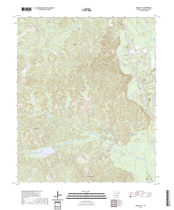
2024 Map of Bragg City
USGS Topo · Published 2024About this map
Bragg City stands as a central point in this Ouachita County landscape, where the wooded uplands meet the complex hydrology of the Ouachita River valley. The map reveals a settlement pattern tied to family and community history, evidenced by Bragg Cem, Green Cem, and Tate Cem. The terrain is deeply carved by drainage systems like Ecore Fabre Bayou and Bragg Mill Creek, which feed into a network of bottomland features such as Saxon Lake and Moon Lake. The southeastern portion of the map is particularly defined by the meandering river and its associated landforms, including Old River Island and Upper Old Brake, illustrating the shifting nature of the river's course over time. Roadways like Quachita Road 62 and State Hwy 76 connect the small hubs of Lester and Lester Junction, providing a look at the rural infrastructure in south-central Arkansas.
Find a feature on this map
44 named features on this map. Tap any name to fly to it.
Don’t see what you’re looking for? This feature index may not catch every label — zoom into the map to look around manually.
Map Details
Editions of this 2024 Bragg City Map
This is the sole edition of this map. No revisions or reprints were ever made.
Other maps of this area

1901 · Gurdon
USGS Topo · 1:125,000

1903 · Camden
USGS Topo · 1:125,000

1951 · Camden
USGS Topo · 1:24,000

1953 · El Dorado
USGS Topo · 1:250,000

1957 · El Dorado
USGS Topo · 1:250,000

1958 · El Dorado
USGS Topo · 1:250,000

1960 · El Dorado
USGS Topo · 1:250,000

1970 · Reader
USGS Topo · 1:24,000

1971 · Tates Bluff
USGS Topo · 1:24,000

1971 · Ouachita
USGS Topo · 1:24,000