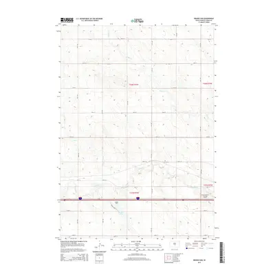
2015 Map of Brakke Dam
USGS Topo · Published 2015About this map
Medicine Cr and its tributaries carve through the rolling Lyman County landscape, defining the hydrology of this South Dakota section. Central to the area is the Brakke Dam, which creates a significant water feature in a region otherwise characterized by agricultural drainages like Nail Cr and Grouse Cr. The presence of the Earling Cem near 240th St offers a point of interest for genealogists tracing local families in this sparsely populated township. Modern infrastructure is represented by the Anderson Aerial Spraying Airport, highlighting the region's continued reliance on aviation for large-scale farming operations. A grid of section roads, including 312th Ave and 237th St, provides the primary framework for movement across the plains, while the Brakke Lake Acc denotes a specific point of entry for local recreation at the reservoir.
Find a feature on this map
27 named features on this map. Tap any name to fly to it.
Don’t see what you’re looking for? This feature index may not catch every label — zoom into the map to look around manually.
Map Details
Editions of this 2015 Brakke Dam Map
This is the sole edition of this map. No revisions or reprints were ever made.
Other maps of this area

1953 · Huron
USGS Topo · 1:250,000

1954 · Pierre
USGS Topo · 1:250,000

1954 · Huron
USGS Topo · 1:250,000

1955 · Martin
USGS Topo · 1:250,000

1955 · Mitchell
USGS Topo · 1:250,000

1958 · Pierre
USGS Topo · 1:250,000

1958 · Martin
USGS Topo · 1:250,000

1959 · Mitchell
USGS Topo · 1:250,000

1966 · Ft. George Butte SE
USGS Topo · 1:24,000

1966 · Joe Creek SE
USGS Topo · 1:24,000