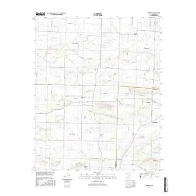
2017 Map of Branch
USGS Topo · Published 2017About this map
Branch and Ratcliff anchor the central corridor of this survey along the border of Franklin and Logan counties. The landscape is a complex network of small rural settlements and family burial grounds, including the King Cem, Hampton Cem, and Moffett Cem situated north of the main townships. Further south, Caulksville sits at a crossroads near the eastern edge of the sheet. The terrain is marked by numerous numbered water bodies, such as Lake Number Thirteen and Lake Number Twentyfour, which appear alongside natural drainages like Sixmile Cr and Hurricane Cr. This 2017 data captures the modern footprint of the region's agricultural and residential layout, revealing how local roads like Peter Pender Ln and Marcusson Hill Rd connect disparate homesteads to the more established communities and landmarks like Metcalf Hill.
Find a feature on this map
106 named features on this map. Tap any name to fly to it.
Don’t see what you’re looking for? This feature index may not catch every label — zoom into the map to look around manually.
Map Details
Editions of this 2017 Branch Map
This is the sole edition of this map. No revisions or reprints were ever made.
Other maps of this area

1887 · Magazine Mountain #2
USGS Topo · 1:62,500

1887 · Magazine Mountain #3
USGS Topo · 1:62,500

1887 · Magazine Mountain
USGS Topo · 1:62,500

1890 · Magazine Mountain
USGS Topo · 1:125,000

1890 · Fort Smith
USGS Topo · 1:125,000

1906 · Lavaca
USGS Topo · 1:62,500

1906 · Barber
USGS Topo · 1:62,500

1934 · Booneville
USGS Topo · 1:48,000

1939 · Booneville
USGS Topo · 1:62,500

1943 · Fort Smith
USGS Topo · 1:125,000