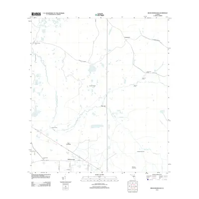
2012 Map of Branchborough
USGS Topo · Published 2012About this map
The Withlacoochee River winds through this central Florida landscape, defining a region characterized by low-lying wetlands and scattered hammocks. Small settlements such as Branchborough and the curiously named Port Lonesome anchor the southern portion of the map, while Cumpressco sits at a major road junction to the north. Local history is evidenced at the Withlacoochee Cem, located near Co Rd 54.
Find a feature on this map
33 named features on this map. Tap any name to fly to it.
Don’t see what you’re looking for? This feature index may not catch every label — zoom into the map to look around manually.
Map Details
Editions of this 2012 Branchborough Map
This is the sole edition of this map. No revisions or reprints were ever made.
Other maps of this area

1944 · Providence
USGS Topo · 1:31,680

1944 · Socrum
USGS Topo · 1:31,680

1947 · Zephyrhills
USGS Topo · 1:24,000

1955 · Plant City
USGS Topo · 1:250,000

1955 · Orlando
USGS Topo · 1:250,000

1957 · Orlando
USGS Topo · 1:250,000

1958 · Orlando
USGS Topo · 1:250,000

1958 · Plant City
USGS Topo · 1:250,000

1959 · Plant City
USGS Topo · 1:250,000

1960 · Lacoochee
USGS Topo · 1:24,000