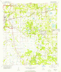
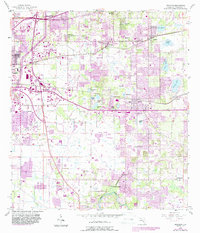
1956 Map of Brandon
USGS Topo · Published 1957About this map
The Alafia River and a dense network of inland lakes define this mid-1950s survey of eastern Hillsborough County. The landscape is characterized by a balance of citrus-era settlement and early industrial activity, with Peat Pits, Strip Mines, and Sandpits scattered among water bodies like Tenmile Lake and Mango Lake. Transportation is dominated by the competing routes of the Atlantic Coast Line and Seaboard Air Line railroads, which facilitated the growth of citrus and shipping hubs such as Brandon, Valrico, and Seffner. Genealogists will find notable landmarks including Providence Ch, Eureka Springs Ch, and the Hackney Cem near Riverview. The southern portion of the map remains largely dominated by the river's winding course and local landmarks like Buckhorn Spring, illustrating the area's geography before the extensive suburbanization that would later reshape the region.
Find a feature on this map
48 named features on this map. Tap any name to fly to it.
Don’t see what you’re looking for? This feature index may not catch every label — zoom into the map to look around manually.
Map Details
Editions of this 1956 Brandon Map
5 editions found
Other maps of this area

1921 · Tampa
USGS Topo · 1:62,500

1943 · Thonotosassa
USGS Topo · 1:24,000

1944 · Sulphur Springs
USGS Topo · 1:31,680

1944 · Mango
USGS Topo · 1:31,680

1944 · Tampa
USGS Topo · 1:31,680

1944 · Thonotosassa
USGS Topo · 1:31,680

1944 · Antioch
USGS Topo · 1:31,680

1944 · Balm
USGS Topo · 1:31,680

1945 · Gadsden Point
USGS Topo · 1:31,680

1945 · Sulphur Springs
USGS Topo · 1:31,680