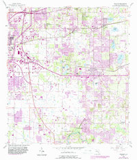
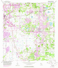
1956 Map of Brandon
USGS Topo · Published 1987About this map
Tampa expansion meets the agricultural landscape of east-central Hillsborough County in this mid-century survey, revised with mid-1980s aerial data. The map documents the shifting character of Brandon, Valrico, and Riverview as residential growth began to fill the spaces between long-established citrus groves and rural nodes. Notable local landmarks like Buckhorn Spring and the Alafia River define the southern landscape, while the northern sections are punctuated by numerous small lakes including Lake Weeks and Lake Hooker. A significant network of rural places of worship, such as Bethel Ch and Bloomingdale Ch, serve as anchors for the local communities. The transition from the industrial and transport-heavy corridors near Orient Park and South Tampa to the interior wetlands of Hickory Hammock Lake and Delaney Creek illustrates the area's varied topography during a period of rapid development.
Find a feature on this map
39 named features on this map. Tap any name to fly to it.
Don’t see what you’re looking for? This feature index may not catch every label — zoom into the map to look around manually.
Map Details
Editions of this 1956 Brandon Map
5 editions found
Other maps of this area

1921 · Tampa
USGS Topo · 1:62,500

1943 · Thonotosassa
USGS Topo · 1:24,000

1944 · Sulphur Springs
USGS Topo · 1:31,680

1944 · Mango
USGS Topo · 1:31,680

1944 · Tampa
USGS Topo · 1:31,680

1944 · Thonotosassa
USGS Topo · 1:31,680

1944 · Antioch
USGS Topo · 1:31,680

1944 · Balm
USGS Topo · 1:31,680

1945 · Gadsden Point
USGS Topo · 1:31,680

1945 · Sulphur Springs
USGS Topo · 1:31,680