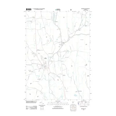
2012 Map of Brandon
USGS Topo · Published 2012About this map
The Forestdale Iron Furnace stands as a testament to the local industrial heritage of Forest Dale, where the Neshobe River flows through Rutland County. This area features a high concentration of burial grounds, including the centrally located Brandon Town Cem and Saint Marys Cem, as well as the outlying Gilbert-Cook Goodrow Cem and June Cem. The landscape is defined by its water systems and bridges, such as the Sanderson Bridge over Otter Cr and the Dean Bridge. To the east, the terrain rises toward Lead Mine Mountain and Chaffee Mountain, while Fern Lake marks the northern boundary near Leicester. Local recreation is noted by the Neshobe Golf Course and the Churchill House Ski Area, reflecting the transition of the region's economy toward its modern character.
Find a feature on this map
116 named features on this map. Tap any name to fly to it.
Don’t see what you’re looking for? This feature index may not catch every label — zoom into the map to look around manually.
Map Details
Editions of this 2012 Brandon Map
This is the sole edition of this map. No revisions or reprints were ever made.
Other maps of this area

1891 · Rutland
USGS Topo · 1:62,500

1893 · Rutland
USGS Topo · 1:62,500

1895 · Castleton
USGS Topo · 1:62,500

1897 · Castleton
USGS Topo · 1:62,500

1902 · Brandon
USGS Topo · 1:62,500

1904 · Brandon
USGS Topo · 1:62,500

1915 · Rochester
USGS Topo · 1:62,500

1917 · Rochester
USGS Topo · 1:62,500

1920 · Brandon
USGS Topo · 1:62,500
1943 · Cornwall
USGS Topo · 1:31,680