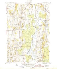
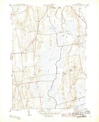
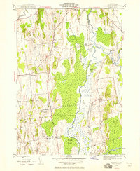
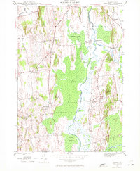
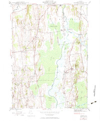
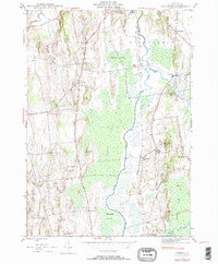
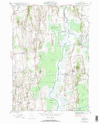
1943 Map of Cornwall
USGS Topo · Published 1943About this map
Otter Creek meanders through the heart of this landscape, flanked by the expansive Cedar Swamp and Whiting Swamp. The terrain is defined by dramatic rises such as The Ledges and Scove Hill, which stand above the marshy lowlands. Settlement patterns in the 1940s reveal a network of numbered schoolhouses and small rural hubs like West Cornwall and West Salisbury. The presence of the Rutland railroad line running parallel to the creek underscores the importance of rail transport to these agricultural communities, connecting points like Salisbury Sta to larger markets. Genealogy researchers will find significant value in the detailed locations of family-named landmarks like Wainwright Hill and several burial grounds, including Evergreen Cem and Pleasant View Cem. The northern portion of the map includes local institutions such as the Middlebury Country Club and Porter Hospital, reflecting the development of the area near the township borders.
Find a feature on this map
43 named features on this map. Tap any name to fly to it.
Don’t see what you’re looking for? This feature index may not catch every label — zoom into the map to look around manually.
Map Details
Editions of this 1943 Cornwall Map
7 editions found
Other maps of this area

1894 · Port Henry
USGS Topo · 1:62,500

1894 · Ticonderoga
USGS Topo · 1:62,500

1896 · Ticonderoga
USGS Topo · 1:62,500

1898 · Port Henry
USGS Topo · 1:62,500

1902 · Ticonderoga
USGS Topo · 1:62,500

1902 · Brandon
USGS Topo · 1:62,500

1903 · Middlebury
USGS Topo · 1:62,500

1904 · Brandon
USGS Topo · 1:62,500

1905 · Middlebury
USGS Topo · 1:62,500

1920 · Brandon
USGS Topo · 1:62,500