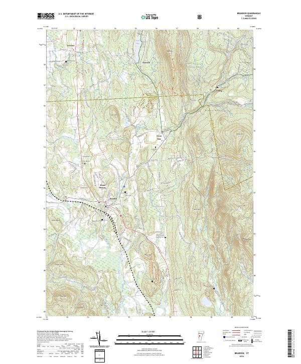
2024 Map of Brandon
USGS Topo · Published 2024About this map
Brandon sits at the western edge of the Green Mountains, where the Neshobe River flows toward the Otter Creek valley. This 2024 survey captures the distinct transition from the forested peaks of the Green Mountain National Forest to the clustered settlements and agricultural lands of Rutland County. The village of Forest Dale and the higher elevations of Goshen characterize the eastern terrain, marked by prominent features like Lead Mine Mtn and Chaffee Mtn.
Find a feature on this map
85 named features on this map. Tap any name to fly to it.
Don’t see what you’re looking for? This feature index may not catch every label — zoom into the map to look around manually.
Map Details
Editions of this 2024 Brandon Map
This is the sole edition of this map. No revisions or reprints were ever made.
Other maps of this area

1891 · Rutland
USGS Topo · 1:62,500

1893 · Rutland
USGS Topo · 1:62,500

1895 · Castleton
USGS Topo · 1:62,500

1897 · Castleton
USGS Topo · 1:62,500

1902 · Brandon
USGS Topo · 1:62,500

1904 · Brandon
USGS Topo · 1:62,500

1915 · Rochester
USGS Topo · 1:62,500

1917 · Rochester
USGS Topo · 1:62,500

1920 · Brandon
USGS Topo · 1:62,500
1943 · Cornwall
USGS Topo · 1:31,680