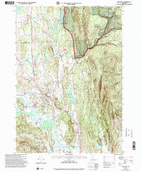
1997 Map of Brandon
USGS Topo · Published 2000About this map
The town of Brandon serves as the central hub of this late-20th-century survey, situated where the Neshobe River meets the winding Otter Creek valley. The map reveals a landscape defined by its transition from valley wetlands like Smalley Swamp and Jones Mill Pond to the steep rises of the Green Mountain National Forest. Cultural landmarks are prominent, including the Brandon State School and the Churchill House (Hotel) near Forest Dale, alongside older institutional footprints like School No 1 and School No 2 in Leicester.
Find a feature on this map
38 named features on this map. Tap any name to fly to it.
Don’t see what you’re looking for? This feature index may not catch every label — zoom into the map to look around manually.
Map Details
Editions of this 1997 Brandon Map
This is the sole edition of this map. No revisions or reprints were ever made.
Other maps of this area

1891 · Rutland
USGS Topo · 1:62,500

1893 · Rutland
USGS Topo · 1:62,500

1895 · Castleton
USGS Topo · 1:62,500

1897 · Castleton
USGS Topo · 1:62,500

1902 · Brandon
USGS Topo · 1:62,500

1904 · Brandon
USGS Topo · 1:62,500

1915 · Rochester
USGS Topo · 1:62,500

1917 · Rochester
USGS Topo · 1:62,500

1920 · Brandon
USGS Topo · 1:62,500
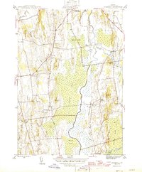
1943 · Cornwall
USGS Topo · 1:31,680