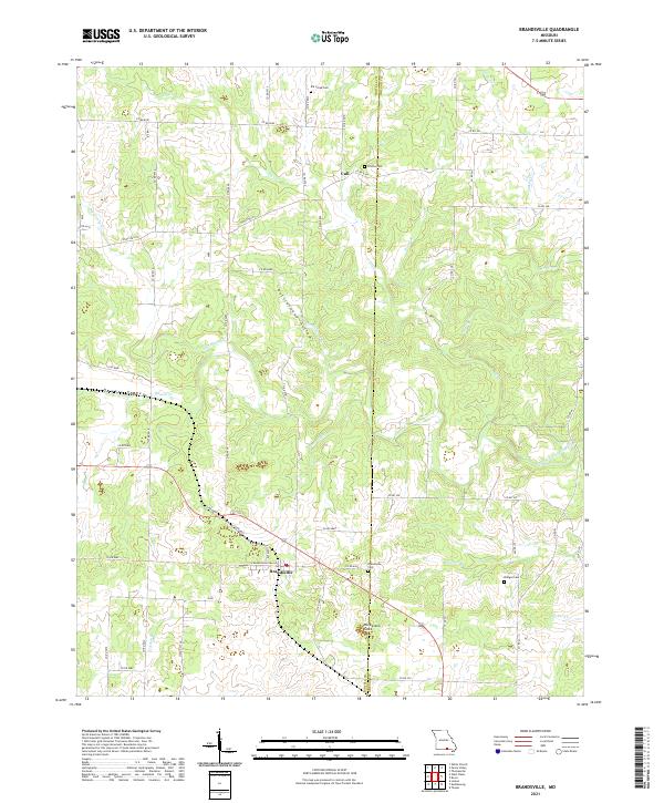
2021 Map of Brandsville
USGS Topo · Published 2021About this map
Brandsville and the small settlement of Cull anchor this portion of the Ozark landscape along the boundary between Howell and Oregon counties. The topography is defined by complex drainage systems and karst features, most notably the Harbeston Sink and the broad Howell Valley. Waterways such as Elk Creek, Big Greasy Creek, and the Warm Fork Spring River carve through the terrain, illustrating the region's intricate hydrography.
Find a feature on this map
55 named features on this map. Tap any name to fly to it.
Don’t see what you’re looking for? This feature index may not catch every label — zoom into the map to look around manually.
Map Details
Editions of this 2021 Brandsville Map
This is the sole edition of this map. No revisions or reprints were ever made.
Other maps of this area

1938 · West Plains
USGS Topo · 1:24,000

1940 · West Plains
USGS Topo · 1:24,000

1943 · Thayer
USGS Topo · 1:62,500

1944 · West Plains
USGS Topo · 1:62,500

1945 · Willow Springs
USGS Topo · 1:62,500

1945 · Montier
USGS Topo · 1:62,500

1946 · Thayer
USGS Topo · 1:62,500

1946 · West Plains
USGS Topo · 1:62,500

1948 · Montier
USGS Topo · 1:62,500

1948 · Willow Springs
USGS Topo · 1:62,500