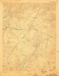
1895 Map of Brandywine
USGS Topo · Published 1899About this map
The agricultural landscape of Southern Maryland at the close of the nineteenth century is defined here by its rail-dependent settlements and the extensive wetlands of Zekiah Swamp. The Pope Creek Branch of the Baltimore and Potomac R. R. serves as a central spine, connecting established hubs like Brandywine and Waldorf with smaller sidings and stations. Evidence of nineteenth-century dual naming persists in several locales, such as Townshend (Osborne), Malcolm (Woodville), and Duffield (Middletown), reflecting a period of transition in local nomenclature. Social infrastructure is visible through landmarks like the Reform School near Cheltenham and the aptly named Burnt Store to the south. The southern portion of the map traces the early development of La Plata and the Port Tobacco Sta., while the intricate drainage of Mattawoman Creek and Piscataway Creek highlights the area's complex hydrology before modern suburban expansion.
Find a feature on this map
45 named features on this map. Tap any name to fly to it.
Don’t see what you’re looking for? This feature index may not catch every label — zoom into the map to look around manually.
Map Details
Editions of this 1895 Brandywine Map
2 editions found

Other maps of this area

1889 · Fredericksburg
USGS Topo · 1:125,000

1890 · Mt. Vernon
USGS Topo · 1:125,000

1891 · Mt. Vernon
USGS Topo · 1:125,000

1892 · Leonardtown
USGS Topo · 1:62,500

1892 · Fredericksburg
USGS Topo · 1:125,000

1892 · Prince Frederick
USGS Topo · 1:62,500

1892 · Brandywine
USGS Topo · 1:62,500

1892 · Owensville
USGS Topo · 1:62,500

1894 · Wicomico
USGS Topo · 1:62,500

1894 · Fredericksburg
USGS Topo · 1:125,000