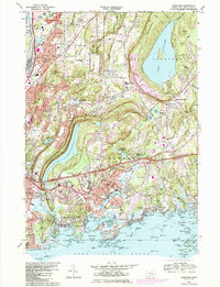
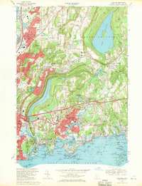
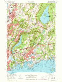
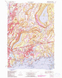
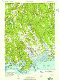
1967 Map of Branford
USGS Topo · Published 1984About this map
Lake Gaillard and Lake Saltonstall dominate the central and northern landscape of this New Haven County survey, which provides a detailed view of the Connecticut shoreline before later coastal expansion. The map records the dense network of early suburban growth and industrial infrastructure, from the Conrail and Amtrak rail corridors to the Connecticut Turnpike. Local history is preserved in the numerous burial grounds like Bare Plain Cem and Mill Plain Cem, alongside established institutions like the Montowese Sch and the Village Street Sch. To the south, the intricate coastline around Branford Harbor and Stony Creek is shown with its many small islands, including Umbrella I and Spectacle I. The topographical contrast between the maritime environment of Indian Neck and the prominent ridge of Totoket Mountain reveals the geological diversity that shaped the region's development.
Find a feature on this map
141 named features on this map. Tap any name to fly to it.
Don’t see what you’re looking for? This feature index may not catch every label — zoom into the map to look around manually.
Map Details
Editions of this 1967 Branford Map
4 editions found
Other maps of this area

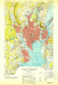
1892 · New Haven
USGS Topo · 1:62,500

1893 · Guilford
USGS Topo · 1:62,500

1921 · New Haven
USGS Topo · 1:62,500

1943 · Durham
USGS Topo · 1:25,000
1943 · New Haven
USGS Topo · 1:31,680

1947 · Hartford
USGS Topo · 1:250,000

1948 · Hartford
USGS Topo · 1:250,000
1951 · Woodmont
USGS Topo · 1:31,680
1953 · Durham
USGS Topo · 1:31,680
1954 · Guilford
USGS Topo · 1:31,680