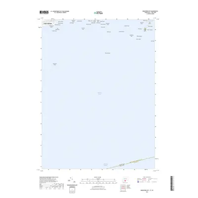
2023 Map of Branford OE S
USGS Topo · Published 2023About this map
Momauguin Beach and the shoreline of East Haven anchor the northwestern edge of this maritime study, which focuses primarily on the numerous rocky hazards and small islands of the Long Island Sound. The map details a complex coastal geography where Johnson Point and Jeffrey Point define the northern harbor approaches. Further out, the Thimble Islands chain appears, including Outer Island, Pot Island, and the interestingly named Kidd Harbor. Navigation is the central theme here, as the survey carefully plots submerged and semi-exposed hazards like Branford Reef, Townshend Ledge, and Hookers Rock. The southern portion of the sheet is dominated by open water, marked only by the state boundary between Connecticut and New York and the Intracostal Waterway corridor used by commercial and recreational vessels traversing the sound.
Find a feature on this map
41 named features on this map. Tap any name to fly to it.
Don’t see what you’re looking for? This feature index may not catch every label — zoom into the map to look around manually.
Map Details
Editions of this 2023 Branford OE S Map
This is the sole edition of this map. No revisions or reprints were ever made.
Other maps of this area

1892 · New Haven
USGS Topo · 1:62,500

1893 · Guilford
USGS Topo · 1:62,500

1921 · New Haven
USGS Topo · 1:62,500

1943 · New Haven
USGS Topo · 1:31,680

1947 · Hartford
USGS Topo · 1:250,000

1948 · Hartford
USGS Topo · 1:250,000
1951 · Woodmont
USGS Topo · 1:31,680

1954 · Guilford
USGS Topo · 1:31,680
1954 · New Haven
USGS Topo · 1:31,680
1954 · Branford
USGS Topo · 1:31,680
Featured Places
- Riverhead, NY
- Branford, CT
- East Haven, CT
- Suffolk County, NY
- South Central Connecticut Planning Region, CT