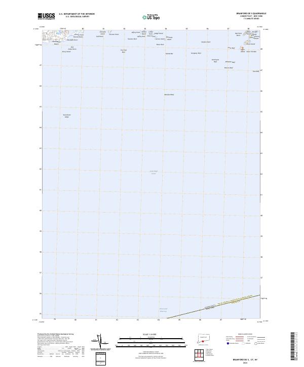
2024 Map of Branford OE S
USGS Topo · Published 2024About this map
Stewart B McKinney National Wildlife Refuge anchors the coastal landscape of this coastal survey, where the rocky shoreline of Connecticut meets the open waters of Long Island Sound. The map reveals a complex maritime environment defined by numerous small islands and hazardous outcrops, including Stony Island, Umbrella Island, and the cluster of High Island and Money Island. Along the northern edge, residential and recreational shorelines like Momauguin Beach and Sunset Beach transition into the natural inlets and points of Mansfield Point and Johnson Point. The southern portion of the sheet is dominated by the open sound, marked by deep-water navigational hazards such as Northwest Reef and the Intracoastal Waterway, which cuts across the lower boundary. This document provides a contemporary record of the boundary between Connecticut and New York, illustrating the enduring importance of these coastal features for local navigation and conservation.
Find a feature on this map
44 named features on this map. Tap any name to fly to it.
Don’t see what you’re looking for? This feature index may not catch every label — zoom into the map to look around manually.
Map Details
Editions of this 2024 Branford OE S Map
This is the sole edition of this map. No revisions or reprints were ever made.
Other maps of this area

1892 · New Haven
USGS Topo · 1:62,500

1893 · Guilford
USGS Topo · 1:62,500

1921 · New Haven
USGS Topo · 1:62,500

1943 · New Haven
USGS Topo · 1:31,680

1947 · Hartford
USGS Topo · 1:250,000

1948 · Hartford
USGS Topo · 1:250,000
1951 · Woodmont
USGS Topo · 1:31,680

1954 · Guilford
USGS Topo · 1:31,680
1954 · New Haven
USGS Topo · 1:31,680
1954 · Branford
USGS Topo · 1:31,680
Featured Places
- Riverhead, NY
- Branford, CT
- East Haven, CT
- Suffolk County, NY
- South Central Connecticut Planning Region, CT