
1951 Map of Branscomb
USGS Topo · Published 1953About this map
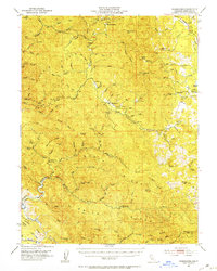
Branscomb and the surrounding Mendocino County backcountry were defined by the timber and ranching activities of the early 1950s. The settlement at Branscomb sits near the South Fork Eel River, serving as a focal point for the region's scattered agricultural and residential outposts like O'Conner Orchard and the Wilderness Lodge. This period shows a landscape transitioning between remote wilderness and managed resource extraction, evidenced by the presence of a Landing Strip near the Laytonville Rancheria.
Find a feature on this map
86 named features on this map. Tap any name to fly to it.
Don’t see what you’re looking for? This feature index may not catch every label — zoom into the map to look around manually.
Map Details
Editions of this 1951 Branscomb Map
4 editions found
Other maps of this area

1920 · Glenblair
USGS Topo · 1:62,500

1920 · Cummings
USGS Topo · 1:62,500

1920 · Covelo
USGS Topo · 1:62,500

1920 · Fort Bragg
USGS Topo · 1:62,500

1921 · Westport
USGS Topo · 1:62,500

1921 · Branscomb
USGS Topo · 1:62,500

1922 · Willits
USGS Topo · 1:62,500

1942 · Willits
USGS Topo · 1:62,500

1943 · Glenblair
USGS Topo · 1:62,500

1943 · Fort Bragg
USGS Topo · 1:62,500