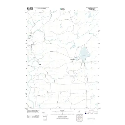
2013 Map of Brantingham
USGS Topo · Published 2013About this map
Brantingham and the surrounding Lewis County landscape sit at the western edge of the Adirondack Park Preserve, defined by a transition from the agricultural lowlands of the Black River valley to the lake-studded uplands. In the early 21st century, the area around Brantingham Lake remains a focal point for settlement, with clustered residences near Pleasant Lake and Lily Pond. To the west, the hamlet of Greig serves as a rural crossroads between the valley and the forested interior.
Find a feature on this map
84 named features on this map. Tap any name to fly to it.
Don’t see what you’re looking for? This feature index may not catch every label — zoom into the map to look around manually.
Map Details
Editions of this 2013 Brantingham Map
This is the sole edition of this map. No revisions or reprints were ever made.
Other maps of this area

1905 · Port Leyden
USGS Topo · 1:62,500

1907 · Port Leyden
USGS Topo · 1:62,500

1911 · Lowville
USGS Topo · 1:62,500

1912 · Number Four
USGS Topo · 1:62,500

1912 · Mc Keever
USGS Topo · 1:62,500

1913 · Lowville
USGS Topo · 1:62,500

1915 · Number Four
USGS Topo · 1:62,500

1940 · Port Leyden
USGS Topo · 1:62,500

1950 · Utica
USGS Topo · 1:250,000

1957 · Utica
USGS Topo · 1:250,000