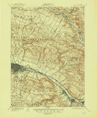
1957 Map of Utica
USGS Topo · Published 1957About this map
The Mohawk Valley and the southern reaches of the Adirondack Mountains anchor this mid-century view of Central New York. Industrial hubs like Utica, Rome, and Watertown are shown at a peak of post-war development, connected by the burgeoning New York State Thruway and the established lines of the New York Central railroad. This survey captures the transition from the dense urban grids of the valley to the wilder, lake-dotted expanse of the Tug Hill and the northern wilderness.
Find a feature on this map
25 named features on this map. Tap any name to fly to it.
Don’t see what you’re looking for? This feature index may not catch every label — zoom into the map to look around manually.
Map Details
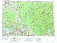
Editions of this 1957 Utica Map
This is the sole edition of this map. No revisions or reprints were ever made.
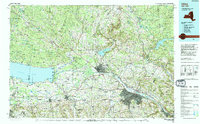
Historical Maps of Utica Through Time
8 maps found