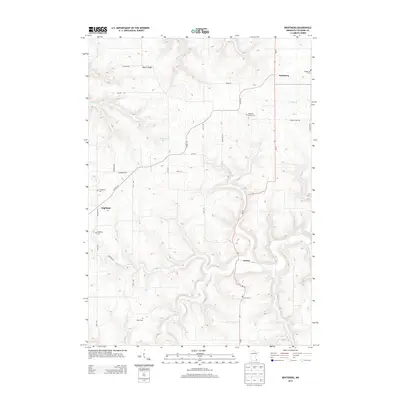
2013 Map of Bratsberg
USGS Topo · Published 2013About this map
Bratsberg and the surrounding farming landscape of Fillmore County are defined by the winding creek valleys and ridges of southeastern Minnesota. The settlement of Choice sits in the valley near Shattuck Cr, while Highland occupies higher ground to the west. This 2013 survey is particularly valuable for genealogists, as it documents several historic burial sites tied to the area's early Norwegian-American heritage, including Highland Prairie Cem and Kopperud Cem. The terrain is marked by distinctive features such as Pigtail Ridge and numerous small waterways like Diamond Cr and Wiset Cr. A network of secondary roads, such as Co Hwy-10 and Bear Paw Rd, connects these rural communities across the dissected plateau.
Find a feature on this map
32 named features on this map. Tap any name to fly to it.
Don’t see what you’re looking for? This feature index may not catch every label — zoom into the map to look around manually.
Map Details
Editions of this 2013 Bratsberg Map
This is the sole edition of this map. No revisions or reprints were ever made.
Other maps of this area

1954 · Lewiston
USGS Topo · 1:62,500

1958 · Houston
USGS Topo · 1:62,500

1958 · La Crosse
USGS Topo · 1:250,000

1961 · La Crosse
USGS Topo · 1:250,000

1965 · La Crosse
USGS Topo · 1:250,000

1965 · Mabel
USGS Topo · 1:24,000

1965 · Spring Grove
USGS Topo · 1:24,000

1965 · Canton
USGS Topo · 1:24,000

1965 · Yucatan
USGS Topo · 1:24,000

1965 · Bratsberg
USGS Topo · 1:24,000