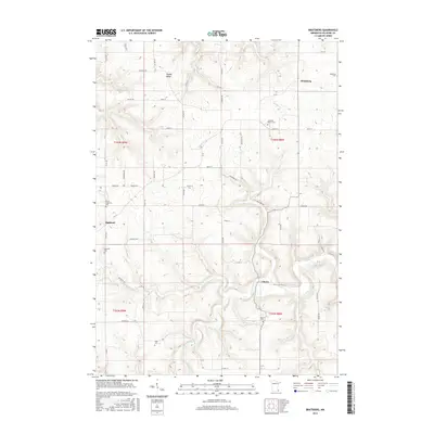
2016 Map of Bratsberg
USGS Topo · Published 2016About this map
Highland and the surrounding Fillmore County agricultural landscape are defined by the winding course of the S Fork Root River and its varied tributaries. The terrain transitions from the elevated Pigtail Ridge in the north to the deeply carved valleys shaped by Shattuck Cr and Wisel Cr. Small rural hubs like Bratsberg and Choice anchor the township divisions of t103n r8w and t102n r9w, connected by a network of gravel and paved roads including Co HWY 37 and Co HWY 12. For those tracing local heritage, the map is remarkably dense with burial sites, such as Highland Prairie Cem and Kopperud Cem, which offer significant genealogical value for families tied to these driftless area settlements.
Find a feature on this map
60 named features on this map. Tap any name to fly to it.
Don’t see what you’re looking for? This feature index may not catch every label — zoom into the map to look around manually.
Map Details
Editions of this 2016 Bratsberg Map
This is the sole edition of this map. No revisions or reprints were ever made.
Other maps of this area

1954 · Lewiston
USGS Topo · 1:62,500

1958 · Houston
USGS Topo · 1:62,500

1958 · La Crosse
USGS Topo · 1:250,000

1961 · La Crosse
USGS Topo · 1:250,000

1965 · La Crosse
USGS Topo · 1:250,000

1965 · Mabel
USGS Topo · 1:24,000

1965 · Spring Grove
USGS Topo · 1:24,000

1965 · Canton
USGS Topo · 1:24,000

1965 · Yucatan
USGS Topo · 1:24,000

1965 · Bratsberg
USGS Topo · 1:24,000