
1965 Map of Bratsberg
USGS Topo · Published 1966About this map
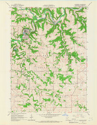
Pigtail Ridge and the winding course of the South Fork Root River define the topography of Fillmore County in this mid-1960s study. The landscape is a mix of agricultural uplands and the heavily wooded coulees of the Minnesota Memorial Hardwood State Forest. Small rural nodes like Bratsberg and Choice anchor the community, supported by established institutions such as Highland Prairie Ch and local education centers including School No 508. The map documents a traditional rural infrastructure with several generational landmarks, including Kopperud Cem and Highland Cem, alongside the working landscape of various limestone Quarries. From the creek beds of Shattuck Creek to the high ground in Norway and Holt townships, the map preserves the precise layout of roads and farmsteads before late-century consolidation.
Find a feature on this map
25 named features on this map. Tap any name to fly to it.
Don’t see what you’re looking for? This feature index may not catch every label — zoom into the map to look around manually.
Map Details
Editions of this 1965 Bratsberg Map
This is the sole edition of this map. No revisions or reprints were ever made.
Other maps of this area

1954 · Lewiston
USGS Topo · 1:62,500

1958 · Houston
USGS Topo · 1:62,500

1958 · La Crosse
USGS Topo · 1:250,000

1961 · La Crosse
USGS Topo · 1:250,000

1965 · La Crosse
USGS Topo · 1:250,000

1965 · Mabel
USGS Topo · 1:24,000

1965 · Spring Grove
USGS Topo · 1:24,000

1965 · Canton
USGS Topo · 1:24,000

1965 · Yucatan
USGS Topo · 1:24,000
1965 · Lanesboro
USGS Topo · 1:24,000