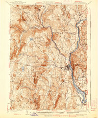
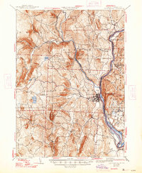
1935 Map of Brattleboro
USGS Topo · Published 1939About this map
The Connecticut River serves as the eastern pulse of this mid-1930s landscape, marking the vital border between Vermont and New Hampshire. This era shows a well-established network of riverfront and upland settlements, where the Boston and Maine Railroad follows the valley floor, connecting depots at Putney Station, Dummerston Station, and Vernon Station. Further inland, the narrow-gauge Brattleboro and Whitehall Railroad winds along Westmoreland toward the interior hills. Regional industry and community life are evident through features like the Quarry near West Dummerston, the Oak Grove Cem, and local schoolhouses including Monument Sch and The Plains Sch. The terrain is defined by named heights such as Governors Mountain and Round Mountain, with small clusters of development at Guilford Center, Williamsville, and West Brattleboro reflecting a landscape shaped by both the river economy and hard-scrabble upland farming.
Find a feature on this map
69 named features on this map. Tap any name to fly to it.
Don’t see what you’re looking for? This feature index may not catch every label — zoom into the map to look around manually.
Map Details
Editions of this 1935 Brattleboro Map
5 editions found
Other maps of this area

1886 · Hawley
USGS Topo · 1:62,500

1887 · Warwick
USGS Topo · 1:62,500

1889 · Warwick
USGS Topo · 1:62,500

1889 · Wilmington
USGS Topo · 1:62,500

1890 · Hawley
USGS Topo · 1:62,500

1890 · Greenfield
USGS Topo · 1:62,500

1891 · Wilmington
USGS Topo · 1:62,500

1891 · Brattleboro
USGS Topo · 1:62,500

1893 · Brattleboro
USGS Topo · 1:62,500

1894 · Greenfield
USGS Topo · 1:62,500