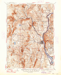
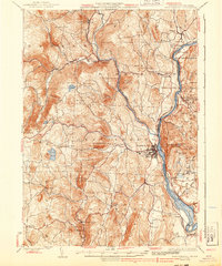
1935 Map of Brattleboro
USGS Topo · Published 1947About this map
Brattleboro serves as the focal point of this mid-1930s landscape, situated where the Whetstone Brook meets the Connecticut River. The region's industrial and transport foundations are visible through the path of the Boston and Maine Railroad, which parallels the river, and the Quarry located near Black Mountain. These features indicate a local economy tied closely to stone extraction and rail commerce during the pre-war era.
Find a feature on this map
73 named features on this map. Tap any name to fly to it.
Don’t see what you’re looking for? This feature index may not catch every label — zoom into the map to look around manually.
Map Details
Editions of this 1935 Brattleboro Map
5 editions found
Other maps of this area

1886 · Hawley
USGS Topo · 1:62,500

1887 · Warwick
USGS Topo · 1:62,500

1889 · Warwick
USGS Topo · 1:62,500

1889 · Wilmington
USGS Topo · 1:62,500

1890 · Hawley
USGS Topo · 1:62,500

1890 · Greenfield
USGS Topo · 1:62,500

1891 · Wilmington
USGS Topo · 1:62,500

1891 · Brattleboro
USGS Topo · 1:62,500

1893 · Brattleboro
USGS Topo · 1:62,500

1894 · Greenfield
USGS Topo · 1:62,500