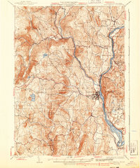
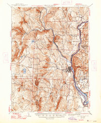
1935 Map of Brattleboro
USGS Topo · Published 1939About this map
Brattleboro serves as the economic and transit anchor for this Windham County landscape, where the confluence of Whetstone Brook and the Connecticut River dictated early industrial and railroad development. Surveyed in part by G.E. Hyde and A.T. Fowler, the map illustrates a transition from the river-valley commerce of the Boston and Maine Railroad to the high-elevation farming and timber tracts of the Green Mountains.
Find a feature on this map
72 named features on this map. Tap any name to fly to it.
Don’t see what you’re looking for? This feature index may not catch every label — zoom into the map to look around manually.
Map Details
Editions of this 1935 Brattleboro Map
5 editions found
Other maps of this area

1886 · Hawley
USGS Topo · 1:62,500

1887 · Warwick
USGS Topo · 1:62,500

1889 · Warwick
USGS Topo · 1:62,500

1889 · Wilmington
USGS Topo · 1:62,500

1890 · Hawley
USGS Topo · 1:62,500

1890 · Greenfield
USGS Topo · 1:62,500

1891 · Wilmington
USGS Topo · 1:62,500

1891 · Brattleboro
USGS Topo · 1:62,500

1893 · Brattleboro
USGS Topo · 1:62,500

1894 · Greenfield
USGS Topo · 1:62,500