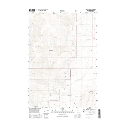
2014 Map of Brays Canyon
USGS Topo · Published 2014About this map
Big Hole Divide forms the primary topographical spine of this region, separating the drainage systems within the Beaverhead National Forest. This 2014 survey documents a landscape defined by an intricate network of creeks, including the Left Fork Swamp Cr and Right Fork Swamp Cr in the north, and the extensive Buffalo Creek system to the south. The presence of Buffalo Creek Rd and Reservoir Creek Rd indicates the primary corridors of movement through these high-altitude basins. To the east, the terrain opens into the Grasshopper Valley, a distinct contrast to the more confined geography of Brays Canyon and Browns Canyon. The map provides a detailed view of these natural drainages before they exit the forest boundary, illustrating the complex hydrology of the Middle Fork Buffalo Cr and its various tributaries like Straight Fork Buffalo Cr.
Find a feature on this map
43 named features on this map. Tap any name to fly to it.
Don’t see what you’re looking for? This feature index may not catch every label — zoom into the map to look around manually.
Map Details
Editions of this 2014 Brays Canyon Map
This is the sole edition of this map. No revisions or reprints were ever made.
Other maps of this area

1955 · Dillon
USGS Topo · 1:250,000

1957 · Dillon
USGS Topo · 1:250,000

1958 · Dillon
USGS Topo · 1:250,000

1959 · Polaris
USGS Topo · 1:62,500

1959 · Grant
USGS Topo · 1:62,500

1962 · Dillon
USGS Topo · 1:250,000

1965 · Dillon
USGS Topo · 1:250,000

1978 · Butch Hill
USGS Topo · 1:24,000
1978 · Coyote Creek
USGS Topo · 1:24,000
1981 · Salmon
USGS Topo · 1:100,000