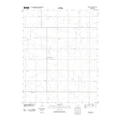
2009 Map of Brazilton
USGS Topo · Published 2009About this map
Brazilton and Greenbush anchor this Crawford County landscape, where the prairie is defined by a grid of rural section roads and the meandering paths of three primary watercourses. The local heritage is remarkably preserved through its burial grounds, including the Lutheran Cemetery in the north and the Iowa Cemetery near the center of the sheet, reflecting the cultural settlement patterns of the region. Lightning Creek drains the eastern portion of the terrain, while Elm Creek and Hickory Creek cut through the western reaches. This 2009 survey by the U. S. Geological Survey captures the quiet agricultural character of the area, punctuated by small clusters of development and well-established family-named sites like the Spangler Cemetery and Mills Cemetery.
Find a feature on this map
25 named features on this map. Tap any name to fly to it.
Don’t see what you’re looking for? This feature index may not catch every label — zoom into the map to look around manually.
Map Details
Editions of this 2009 Brazilton Map
This is the sole edition of this map. No revisions or reprints were ever made.
Other maps of this area

1884 · Fort Scott
USGS Topo · 1:125,000

1886 · Joplin
USGS Topo · 1:125,000

1886 · Iola
USGS Topo · 1:125,000

1886 · Fort Scott
USGS Topo · 1:125,000

1886 · Parsons
USGS Topo · 1:125,000

1893 · Fort Scott
USGS Topo · 1:125,000

1893 · Iola
USGS Topo · 1:125,000

1893 · Parsons
USGS Topo · 1:125,000

1894 · Joplin
USGS Topo · 1:125,000

1904 · Iola
USGS Topo · 1:125,000