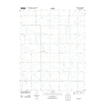
2012 Map of Brazilton
USGS Topo · Published 2012About this map
Brazilton and Greenbush anchor this segment of the Kansas prairie, where the landscape is meticulously divided by a grid of agricultural section roads. The 2012 topography shows a terrain carved by the winding paths of Lightning Cr, Elm Cr, and Hickory Cr, which disrupt the rigid geometry of thoroughfares like W 690th Ave and N 120th St. This area of Crawford County preserves several small burial grounds that reflect the lineage of local families and congregations, including the Spangler Pleasant Valley Cem, Iowa Cem, and the Lutheran Cem. The intersection of E Bredehoeft St in Brazilton serves as a central point in an area otherwise dominated by open fields and farmsteads. This map provides a detailed view of rural land use and drainage patterns in southeastern Kansas at the beginning of the 21st century.
Find a feature on this map
34 named features on this map. Tap any name to fly to it.
Don’t see what you’re looking for? This feature index may not catch every label — zoom into the map to look around manually.
Map Details
Editions of this 2012 Brazilton Map
This is the sole edition of this map. No revisions or reprints were ever made.
Other maps of this area

1884 · Fort Scott
USGS Topo · 1:125,000

1886 · Joplin
USGS Topo · 1:125,000

1886 · Iola
USGS Topo · 1:125,000

1886 · Fort Scott
USGS Topo · 1:125,000

1886 · Parsons
USGS Topo · 1:125,000

1893 · Fort Scott
USGS Topo · 1:125,000

1893 · Iola
USGS Topo · 1:125,000

1893 · Parsons
USGS Topo · 1:125,000

1894 · Joplin
USGS Topo · 1:125,000

1904 · Iola
USGS Topo · 1:125,000