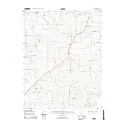
2015 Map of Brazito
USGS Topo · Published 2015About this map
The Osage River marks the southeastern corner of this region, where the terrain transitions into a complex network of creeks and ridges. Settled communities such as Hickory Hill and Brazito are connected by a web of local roads, including Heritage Hwy and Tanner Bridge Rd. The landscape is defined by its water systems, from the winding path of South Moreau Creek and Bois Brule Cr to the smaller drainages of Landing Cr and Honey Cr.
Find a feature on this map
83 named features on this map. Tap any name to fly to it.
Don’t see what you’re looking for? This feature index may not catch every label — zoom into the map to look around manually.
Map Details
Editions of this 2015 Brazito Map
This is the sole edition of this map. No revisions or reprints were ever made.
Other maps of this area

1886 · Jefferson City
USGS Topo · 1:125,000

1888 · Tuscumbia
USGS Topo · 1:125,000

1894 · Tuscumbia
USGS Topo · 1:125,000

1894 · Jefferson City
USGS Topo · 1:125,000

1939 · Jefferson City
USGS Topo · 1:24,000

1939 · Jefferson City
USGS Topo · 1:62,500

1942 · Jefferson City
USGS Topo · 1:62,500

1947 · Jefferson City
USGS Topo · 1:250,000

1948 · Centertown
USGS Topo · 1:62,500

1948 · Meta
USGS Topo · 1:62,500