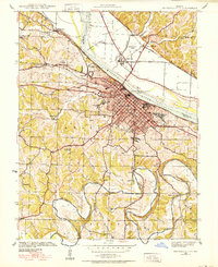
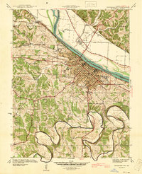
1939 Map of Jefferson City
USGS Topo · Published 1939About this map
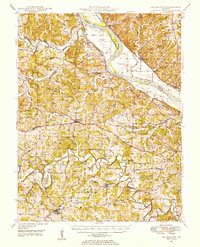
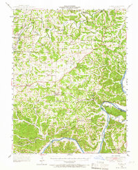
The Missouri River bisects this 1939 landscape, separating the dense grid of Jefferson City from the agricultural lowlands of Callaway County to the north. This survey documents the capital during a period of significant institutional footprint, clearly marking the Penitentiary and the Lincoln Institute campus overlooking the river. To the north, the State Prison Farm and the Jefferson City Airport dominate the river bend near Cedar City. South of the urban center, the terrain transitions into the winding loops of the Moreau River, where rural life is anchored by one-room schoolhouses like Moreau Bend Sch and East Union Sch. The rail infrastructure of the Missouri Pacific and Kansas City and Eastern lines highlights the city's role as a regional transportation hub prior to the full expansion of the modern highway system.
Find a feature on this map
51 named features on this map. Tap any name to fly to it.
Don’t see what you’re looking for? This feature index may not catch every label — zoom into the map to look around manually.
Map Details
Editions of this 1939 Jefferson City Map
2 editions found
Other maps of this area

1886 · Jefferson City
USGS Topo · 1:125,000

1888 · Tuscumbia
USGS Topo · 1:125,000

1894 · Tuscumbia
USGS Topo · 1:125,000

1894 · Jefferson City
USGS Topo · 1:125,000

1939 · Jefferson City
USGS Topo · 1:62,500

1942 · Jefferson City
USGS Topo · 1:62,500

1947 · Jefferson City
USGS Topo · 1:250,000
1948 · Centertown
USGS Topo · 1:62,500
1948 · Meta
USGS Topo · 1:62,500
1948 · Eugene
USGS Topo · 1:62,500
Featured Places
- Jefferson City, MO
- Holts Summit, MO
- Wardsville, MO
- Cole Junction, Jefferson City
- North Jefferson, Jefferson City