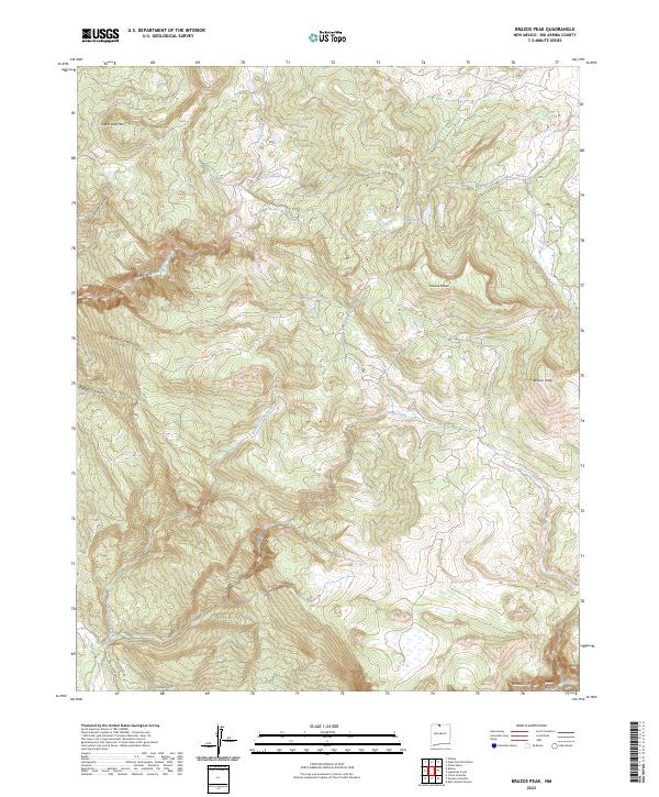
2023 Map of Brazos Peak
USGS Topo · Published 2023About this map
Brazos Peak and the sheer Brazos Cliffs dominate this high-altitude landscape in Rio Arriba County, where the Rio Brazos carves through the southern terrain. This survey reflects a modern view of the Tusas Mountains, illustrating the complex drainage patterns of Chavez Creek and its western forks. The northern reaches are characterized by high mesas and distinct peaks, including Sugar Loaf Mtn and Grouse Mesa, alongside remote water bodies like Hidden Lake. While much of the area remains undeveloped forest and mountain land, the presence of Ticonderoga Dr and Oak Meadows Dr in the southwest suggests residential expansion creeping into the foothills. The map provides a detailed look at geological formations such as the Brazos Box and Cañones Box, where narrow canyons have been cut by seasonal and perennial streams.
Find a feature on this map
22 named features on this map. Tap any name to fly to it.
Don’t see what you’re looking for? This feature index may not catch every label — zoom into the map to look around manually.
Map Details
Editions of this 2023 Brazos Peak Map
This is the sole edition of this map. No revisions or reprints were ever made.
Other maps of this area

1918 · Tusas
USGS Topo · 1:125,000

1954 · Aztec
USGS Topo · 1:250,000

1955 · Chama
USGS Topo · 1:62,500

1955 · Cebolla
USGS Topo · 1:62,500

1955 · Brazos Peak
USGS Topo · 1:62,500

1955 · Tierra Amarilla
USGS Topo · 1:62,500

1958 · Aztec
USGS Topo · 1:250,000

1962 · Aztec
USGS Topo · 1:250,000

1965 · Aztec
USGS Topo · 1:250,000

1981 · Chama
USGS Topo · 1:100,000