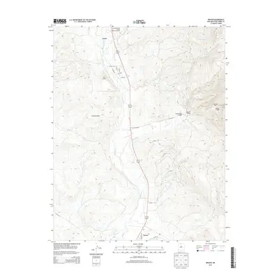
2013 Map of Brazos
USGS Topo · Published 2013About this map
Rio Chama defines the central corridor of this northern New Mexico landscape, winding south from Chama through a valley shaped by significant elevation changes. The settlement pattern is concentrated along the river and irrigation works like the Willow Cr Mesa Ditch, where small communities such as Dos Lomas, Casa Escondida, and Brazos are situated. To the east, the terrain becomes increasingly complex, characterized by steep drainage systems like Cañonizaria Canyon and Doggett Canyon. The presence of the Chama Land and Cattle Company Airport in the north highlights the area's mix of traditional ranching and modern utility. Narrow passages such as the Cañones Box and various named tributaries like Los Alamos Cr illustrate the high-desert drainage patterns typical of Rio Arriba County.
Find a feature on this map
29 named features on this map. Tap any name to fly to it.
Don’t see what you’re looking for? This feature index may not catch every label — zoom into the map to look around manually.
Map Details
Editions of this 2013 Brazos Map
This is the sole edition of this map. No revisions or reprints were ever made.
Other maps of this area

1918 · Tusas
USGS Topo · 1:125,000

1954 · Aztec
USGS Topo · 1:250,000

1955 · Chama
USGS Topo · 1:62,500

1955 · Cebolla
USGS Topo · 1:62,500

1955 · Brazos Peak
USGS Topo · 1:62,500

1955 · Tierra Amarilla
USGS Topo · 1:62,500

1958 · Aztec
USGS Topo · 1:250,000

1962 · Aztec
USGS Topo · 1:250,000

1965 · Aztec
USGS Topo · 1:250,000

1981 · Chama
USGS Topo · 1:100,000