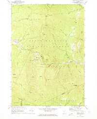
1970 Map of Bread Loaf
USGS Topo · Published 1973About this map
The Middlebury College Snow Bowl and the surrounding peaks of the Green Mountains define this landscape on the border of Addison and Windsor counties. In the early 1970s, the area served as a focal point for backcountry recreation and education, anchored by the high-elevation settlement of Bread Loaf and the Worth Mtn Lodge. The rugged topography is traversed by the Long Trail, which winds past remote landmarks such as Skylight Pond, Battell Mtn, and the Boyce Shelter.
Find a feature on this map
57 named features on this map. Tap any name to fly to it.
Don’t see what you’re looking for? This feature index may not catch every label — zoom into the map to look around manually.
Map Details
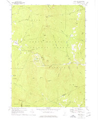
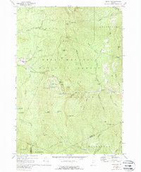
Editions of this 1970 Bread Loaf Map
3 editions found
Other maps of this area

1902 · Brandon
USGS Topo · 1:62,500

1903 · Middlebury
USGS Topo · 1:62,500

1904 · Brandon
USGS Topo · 1:62,500

1905 · Middlebury
USGS Topo · 1:62,500

1915 · Rochester
USGS Topo · 1:62,500

1917 · Rochester
USGS Topo · 1:62,500

1919 · Lincoln Mountain
USGS Topo · 1:62,500

1920 · Lincoln Mountain
USGS Topo · 1:48,000

1920 · Brandon
USGS Topo · 1:62,500

1920 · Middlebury
USGS Topo · 1:62,500