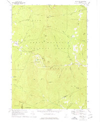
1970 Map of Bread Loaf
USGS Topo · Published 1977About this map
The Green Mountain National Forest dominates this 1970 Vermont survey, where high-elevation landmarks and recreation infrastructure define the land use. The Middlebury College Snow Bowl sits near Middlebury Gap, marking the intersection of educational history and mountain sport. Along the ridgeline, the Long Trail traverses major summits including Bread Loaf Mtn and Battell Mtn, supported by rustic outposts like the Boyce Shelter and Sucker Brook Shelter.
Find a feature on this map
57 named features on this map. Tap any name to fly to it.
Don’t see what you’re looking for? This feature index may not catch every label — zoom into the map to look around manually.
Map Details
Editions of this 1970 Bread Loaf Map
3 editions found
Other maps of this area

1902 · Brandon
USGS Topo · 1:62,500

1903 · Middlebury
USGS Topo · 1:62,500

1904 · Brandon
USGS Topo · 1:62,500

1905 · Middlebury
USGS Topo · 1:62,500

1915 · Rochester
USGS Topo · 1:62,500

1917 · Rochester
USGS Topo · 1:62,500

1919 · Lincoln Mountain
USGS Topo · 1:62,500

1920 · Lincoln Mountain
USGS Topo · 1:48,000

1920 · Brandon
USGS Topo · 1:62,500

1920 · Middlebury
USGS Topo · 1:62,500