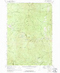
1970 Map of Bread Loaf
USGS Topo · Published 1989About this map
Green Mountain National Forest dominates this mountain landscape in Addison and Windsor counties, where recreation and academic retreats define the local character. The famous Long Trail traverses the high ridges, connecting landmarks like Battell Mtn and Boyce Mtn. At the heart of the quadrangle lies the Bread Loaf settlement and the Middlebury College Snow Bowl, illustrating the long-standing connection between the college and these peaks.
Find a feature on this map
62 named features on this map. Tap any name to fly to it.
Don’t see what you’re looking for? This feature index may not catch every label — zoom into the map to look around manually.
Map Details
Editions of this 1970 Bread Loaf Map
3 editions found
Other maps of this area

1902 · Brandon
USGS Topo · 1:62,500

1903 · Middlebury
USGS Topo · 1:62,500

1904 · Brandon
USGS Topo · 1:62,500

1905 · Middlebury
USGS Topo · 1:62,500

1915 · Rochester
USGS Topo · 1:62,500

1917 · Rochester
USGS Topo · 1:62,500

1919 · Lincoln Mountain
USGS Topo · 1:62,500

1920 · Lincoln Mountain
USGS Topo · 1:48,000

1920 · Brandon
USGS Topo · 1:62,500

1920 · Middlebury
USGS Topo · 1:62,500