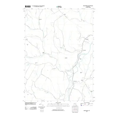
2010 Map of Breakabeen
USGS Topo · Published 2010About this map
Schoharie Creek carves a deep valley through this Central New York landscape, anchoring several small rural settlements that have persisted into the 21st century. The village of Breakabeen sits along the river's western bank, while Fultonham and Watsonville occupy the narrow fertile corridor to the north. Steep terrain rises sharply from the valley floor, leading to high points like Toe Path Mountain and the distinct formation at Walhalla Rocks.
Find a feature on this map
62 named features on this map. Tap any name to fly to it.
Don’t see what you’re looking for? This feature index may not catch every label — zoom into the map to look around manually.
Map Details
Editions of this 2010 Breakabeen Map
This is the sole edition of this map. No revisions or reprints were ever made.
Other maps of this area

1898 · Schoharie
USGS Topo · 1:62,500

1900 · Schoharie
USGS Topo · 1:62,500

1900 · Schoharie
USGS Topo · 1:31,680

1901 · Gilboa
USGS Topo · 1:62,500

1903 · Gilboa
USGS Topo · 1:62,500

1904 · Richmondville
USGS Topo · 1:62,500

1904 · Hobart
USGS Topo · 1:62,500

1943 · Cobleskill
USGS Topo · 1:24,000

1943 · Breakabeen
USGS Topo · 1:24,000
1943 · Schoharie
USGS Topo · 1:24,000