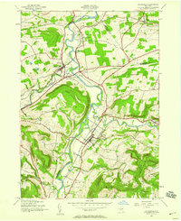
1943 Map of Schoharie
USGS Topo · Published 1959About this map
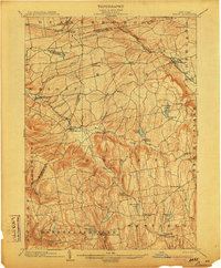
Schoharie serves as the focal point of this mid-century landscape, situated along the winding Schoharie Creek valley where the floodplains meet rising elevations like Terrace Mountain. The village’s historic character is anchored by the Old Stone Fort, while the surrounding rural landscape is dotted with early 20th-century schoolhouses including Barton Hill Sch and School No 13.
Find a feature on this map
40 named features on this map. Tap any name to fly to it.
Don’t see what you’re looking for? This feature index may not catch every label — zoom into the map to look around manually.
Map Details
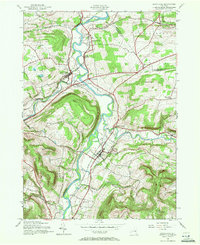
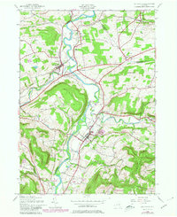
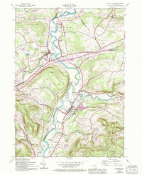
Editions of this 1943 Schoharie Map
4 editions found
Other maps of this area

1895 · Amsterdam
USGS Topo · 1:62,500

1896 · Fonda
USGS Topo · 1:62,500

1898 · Fonda
USGS Topo · 1:62,500

1898 · Schoharie
USGS Topo · 1:62,500

1900 · Schoharie
USGS Topo · 1:62,500

1900 · Schoharie
USGS Topo · 1:31,680

1900 · Berne
USGS Topo · 1:62,500

1902 · Fonda
USGS Topo · 1:62,500
1903 · Berne
USGS Topo · 1:62,500

1931 · Amsterdam
USGS Topo · 1:62,500