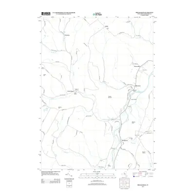
2013 Map of Breakabeen
USGS Topo · Published 2013About this map
Schoharie Cr defines the valley floor of this Schoharie County landscape, where the hamlets of Breakabeen and Fultonham are situated along the river's eastern banks. The terrain rises sharply to the west toward Fulton Hill and Rossman Hill, carved by numerous tributaries including Panther Cr and Cole Brook. Smaller settlements like West Fulton and Watsonville occupy the transition between the fertile valley and the higher ridges.
Find a feature on this map
87 named features on this map. Tap any name to fly to it.
Don’t see what you’re looking for? This feature index may not catch every label — zoom into the map to look around manually.
Map Details
Editions of this 2013 Breakabeen Map
This is the sole edition of this map. No revisions or reprints were ever made.
Other maps of this area

1898 · Schoharie
USGS Topo · 1:62,500

1900 · Schoharie
USGS Topo · 1:62,500

1900 · Schoharie
USGS Topo · 1:31,680

1901 · Gilboa
USGS Topo · 1:62,500

1903 · Gilboa
USGS Topo · 1:62,500

1904 · Richmondville
USGS Topo · 1:62,500

1904 · Hobart
USGS Topo · 1:62,500

1943 · Cobleskill
USGS Topo · 1:24,000

1943 · Breakabeen
USGS Topo · 1:24,000
1943 · Schoharie
USGS Topo · 1:24,000